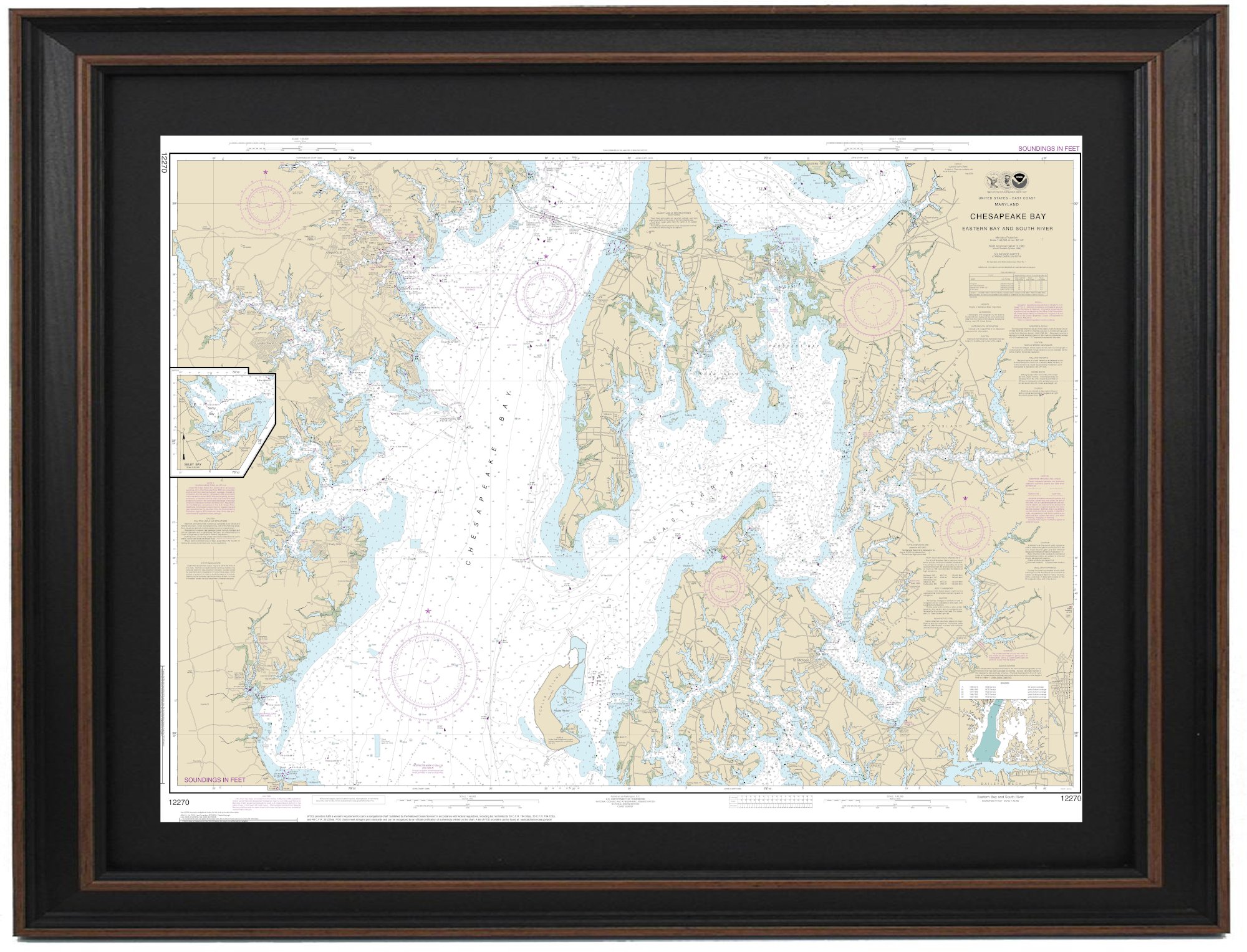
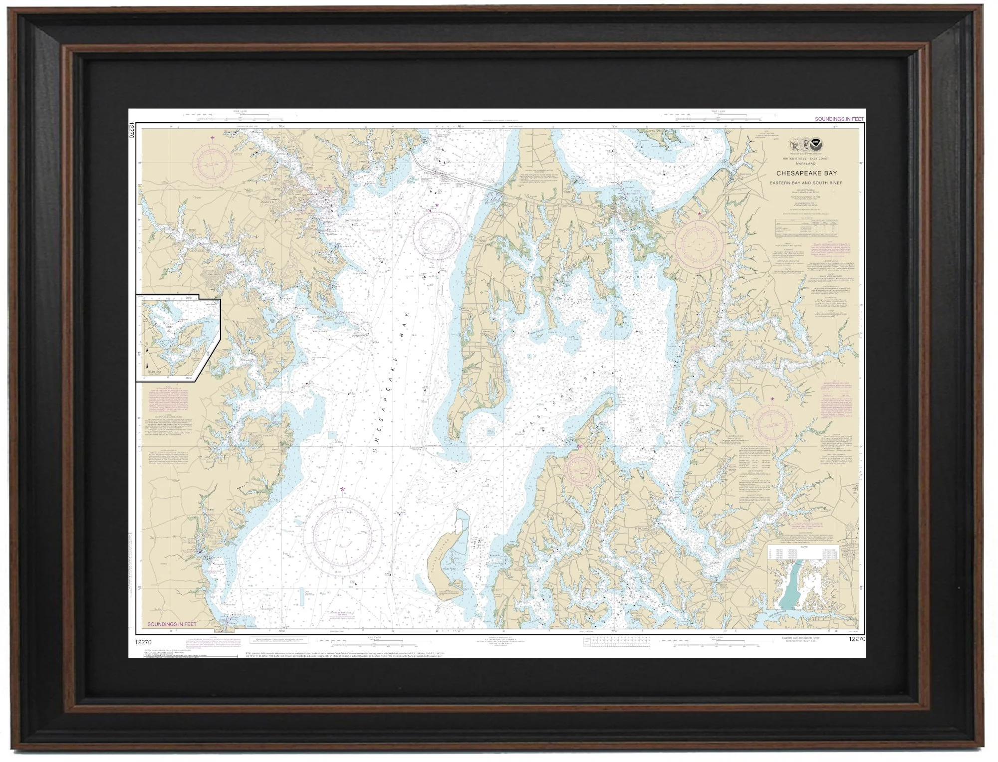
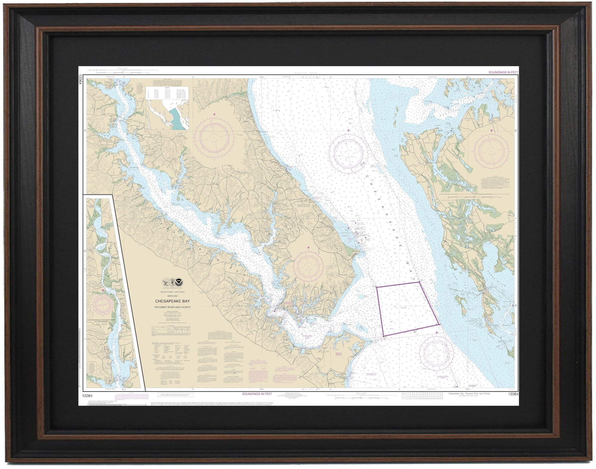
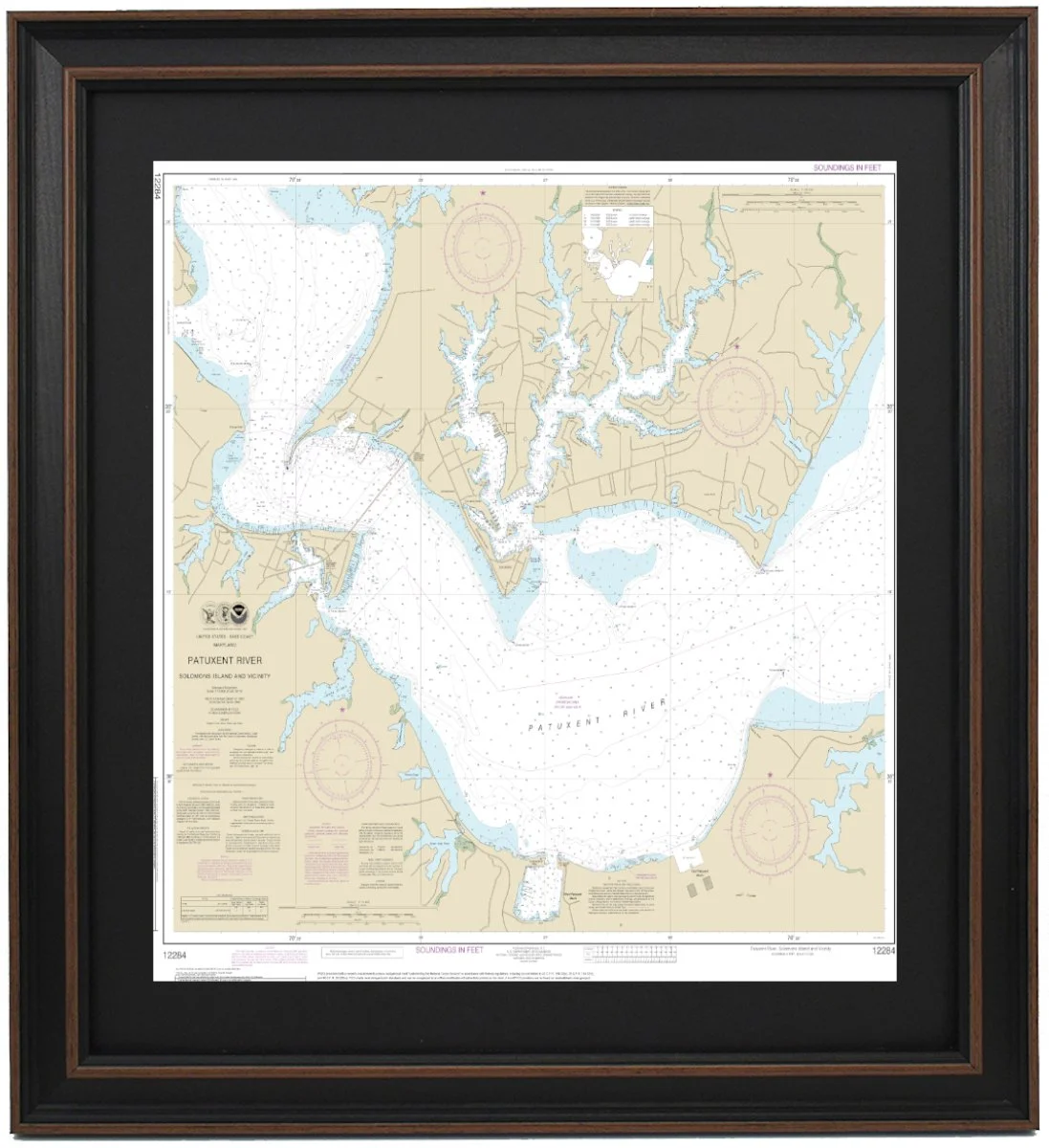
Framed Nautical Maps - Maryland Clear Filters Filter Clear Filter Framed Nautical Map 12280 - Chesapeake Bay from $149.99 Framed Nautical Map 12283 - Annapolis Harbor from $149.99 Framed Nautical Map 12274 - Head of Chesapeake Bay from $149.99 Framed Nautical Map 12270 - Chesapeake Bay, Eastern Bay and South River; Selby Bay from $149.99 Framed Nautical Map 12272 - Chester River; Kent Island Narrows, Rock Hall Harbor and Swan Creek from $149.99 Framed Nautical Map 12278 - Chesapeake Bay Approaches to Baltimore Harbor from $149.99 Framed Nautical Map 12273 - Chesapeake Bay; Sandy Point to Susquehanna River from $149.99 Framed Nautical Map 12264 - Chesapeake Bay; Patuxent River and Vicinity from $149.99 Framed Nautical Map 12284 - Patuxent River Solomons lsland and Vicinity from $149.99 Framed Nautical Map 12289 - Mattawoman Creek to Georgetown from $149.99 No results found No results match your search. Try removing a few filters.